RWGPS地理院標高: A Convenient Add-on for Elevation Data in RWGPS
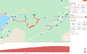
RWGPS地理院標高 is a Chrome add-on developed by 330k that enhances the functionality of RWGPS by allowing users to retrieve elevation data from the Geospatial Information Authority of Japan (GSI) while creating routes.
With this add-on, users can easily access accurate elevation values from the GSI's elevation tiles (Basic Map Information Digital Elevation Model) when creating routes on RWGPS. The add-on attempts to retrieve elevation data from the highest accuracy level available, using 5m/10m mesh tiles.
Enabling or disabling the add-on is as simple as clicking the "地" (elevation) button located in the bottom right corner of the route creation screen.
Please note that this add-on only works within Japan and may not function outside of the country.


